AM New York
March 18, 2024
by
by
Article
Game on: A nonprofit uses video games to improve NYC disaster preparedness
Game on: A nonprofit uses video games to improve NYC disaster preparedness
As a climate scientist and meteorologist, Dr. Anthony Torres has dedicated his career to researching, teaching, and forecasting climate change and extreme weather. Most recently, he worked with Currently, a startup that provides timely and actionable weather forecasts in 20 cities.
Dr. Torres’ academic research on understanding what drives the behavior of carbon dioxide (CO2) measurements from space has been supported by NASA and gave scientists another way to better understand how much CO2 remains in the atmosphere through 2100. His groundbreaking research also helps climate scientists model how global temperatures might change under various emission scenarios.
Dr. Torres recently spoke to the ISR team about the role of meteorologists in working across silos and preparing the public for climate-related crises and disasters.
As a child, I vividly remember being in a tornado outbreak. I spent the day in the pool until the massive storm clouds came rolling in. By the time we closed the pool, the tornado sirens started blaring and we ran to seek shelter in our house. Soon after, winds in excess of 100 mph wreaked havoc in the area. It turned out multiple tornadoes had also touched down nearby. I remember all of the shattered windows, downed trees, blown lawn furniture, and damaged buildings after the storm.
It was the first time I witnessed the extreme power of nature and I wanted to know more about it. Afterwards, I acquired all kinds of weather books, would watch The Weather Channel, and had my own miniature weather station.
There are multiple fronts in which we can improve our preparation for disasters:
First, we need to close the gaps in observations. The US and Europe have dense networks of observations that allow for early detection of weather systems. Even here, gaps in detection networks, such as radar networks in the US, create challenges for detecting tornadoes or other severe weather events. In the Global South, where the density of weather observations is sparser, it is even more challenging to forecast extreme weather events. By closing these gaps, we can better monitor extreme weather events before they happen — giving us the chance to provide adequate warning to everyone affected.
Second, meteorologists need to be more interdisciplinary. While meteorology is a physical science, the impacts from meteorological events are not. The most accurate weather forecast is only as good as how it has been received by its intended audience. Communication is key. We need to work with all of our stakeholders, as well as leverage the expertise of social scientists and disaster experts to build a shared language so that we can maximize the number of people that receive adequate warning of incoming hazards.
First, incentivize interdisciplinary interactions. Meteorologists — especially on television — historically have been “general practitioners” of science as science directors at their respective stations. However, we are only formally trained in a narrow subset of science. This has led to the spread of misleading information, which has real consequences. We need to understand appropriate limits of our own expertise and when to defer to others and ensure that everyone is informed with the best information possible based on the best science available.
Second, build channels with communities affected. Often communication is delivered in a top-down method with few channels for bottom-up communication. Social media has helped level conversations in some ways, but it has not nearly gone far enough. Go into these communities with the intent to learn about what is important to them, and how to build effective communication strategies in advance of a potential crisis. Recognize that these communities are not monolithic and that there is no “one size fits all” solution for crisis preparation.
Finally, incentivize stewardship of our disciplines. The careers of scientists are often rewarded by research and publication metrics with a baseline expectation of service work. By shifting the paradigm to weighing service with respect to broader impacts and reaching out to local communities more heavily, we deconstruct the silos built up by the ivory tower.
Despite any narrative to the contrary, my experience has been that most people genuinely crave access to science knowledge. Anytime someone asks what I do, the conversation shifts to weather and/or climate. Use this as an opportunity to relight the passion that got you into science and share that enthusiasm with the people you meet.
Like any speaking engagement, it is important to know and be comfortable with your audience. An awkward conversation or talk is still awkward, regardless of the topic. Find common ground. Remove as many barriers as you can to maximize the connection you make with your audience.
Every bit of progress we make counts and makes a difference. The more we limit our planet’s warming, the less we will need to deal with climate changes and extreme weather patterns. The more we are prepared for the next disaster, the less dire the consequences. I remain optimistic humanity will learn these lessons and set forth a path to a better future.
In any major climate-related crisis, access to geo-spatial-temporal datasets, mapping, modeling, and analytical tools are critical to aid recovery efforts and protect communities. Many expert researchers, especially scientists and institutions in low-to-middle income countries, lack the tools to access and analyze relevant data, to inform local decision makers on how to act rapidly and effectively.
During a recent panel with the Predictive Analytics World (PAW) climate conference, we spoke with ISR community member Daniel San Martin of Universidad Técnica Federico Santa María in Chile. Daniel specializes in scientific computing with a current research focus on computational fluid dynamics, numerical methods, and high-performance computing applied to forest fire modeling.
Our work is not only based on data, but we also use physical models and simulations to get or evaluate dangerous zones and vulnerable locations. Our approach is to use these simulations to make informed decisions for experts in disaster management, like government institutions. We can also use the models to create new data for AI-based models in order to complement the analysis. The main contribution of our work with wildfires is trying to best inform the people who make the decisions and try to minimize the damage of wildfires.
I think collaboration with a global network is crucial for developing countries, like Chile. We do this to tap into diverse expertise and to gain a global perspective, specifically on disasters. Also, to share resources and build capacity for rapid response. I think different experts in disaster management approach this work in order to help shape policies. I strongly believe that global collaboration is mandatory nowadays to face any kind of disaster, even more so now that we are suffering the effects of climate change.
In terms of data, it is really tricky in my region because of the availability of the technology or the funding to get intelligent data, like they have in the United States. We have a lot of resource constraints, such as spatiotemporal resolution issues, data integration complexities, sharing restrictions, data quality concerns, resource constraints, and remote sensing limitations, among others. We usually try to use the data provided by US or European institutions. We use that data to create models, but it cannot always be applied because we have geographical or meteorological differences. We need data and tech development by other countries, to create or adjust the tools to our own context.
To better support researchers in disasters, enhanced data accessibility through open initiatives and real-time streams is crucial. This includes advocating for standardized formats and integrating advanced remote sensing technologies. To communicate findings effectively to decision makers, user-friendly visualization tools and comprehensive scenario analysis reports are essential. Collaborative engagement with stakeholders, including regular workshops and educational initiatives, can bridge the gap between researchers and decision-makers, fostering understanding and trust.
Additionally, advocating for policy integration and offering training sessions to decision makers can ensure that scientific research is considered in disaster management strategies, ultimately enhancing the impact of simulation models on informed decision-making.
The International Science Reserve is pleased to announce that Chike Aguh, former Chief Innovation Officer at the U.S. Department of Labor, has joined ISR’s Advisory Council.
Under the Biden administration, he led efforts to use data, emerging technologies such as AI and quantum computing, and innovative practice to advance and protect American workers. We sat down with him to talk about what he learned from previous crisis response experiences and why it’s not a time for business as usual.
Data and innovative technology or practice are critical to crisis responses, respectively. During the fast-moving times of a crisis, data that can tell us what is happening and what has happened previously can be scarce. Who has access to data can be a life-or-death situation: people or governments who have it will weather the storm and those who don’t will be swept away by it. Whether it is mapping what symptoms people are searching on Google to determine what type and where pandemics may spring up, to analysis of large research data sets to mitigate these crises, data helps increase the confidence interval of the interventions that leaders must take to keep us all safe.
Whether practice or technology, innovations are also indispensable during a crisis because the general operating procedures generally do not have the scale or speed required to stay ahead of the crisis. Innovations allow us to operate at “the speed of the fight” as my old boss, US Army General Stan McChrystal used to say.
The lessons I learned were elegant and devastating in their simplicity. One, even the most cutting-edge technologies are not a replacement for strategy. Leaders must do the hard intellectual work of identifying the key problems and questions to be solved in a crisis. Only then can these technologies be applied intelligently and effectively.
Two, sociology will overwhelm technology every time. In the space of collaborative research, we can only achieve the collective brilliance of all involved if we have the goodwill and effective means of working together.
And three, the most important power of these technologies is to help us think outside the parameters of normal practice and try things we would never attempt in normal times. We should not simply use these technologies to do the same old things with incrementally better speed or effectiveness, but rather use them to take quantum leaps in impact.
I do. Some of the greatest successes of the COVID-19 response, from vaccine development, testing innovation, treatment deployment, to the High-Performance Computing Consortium (HPCC) show what is possible when traditional siloes are sublimated for the sake of helping everyone.
The key question is: how do we make this new collaborative lens not simply a feature of crisis response, but a key part of operating procedure for all of us? My biggest recommendation is to keep the institutions that we have created like the HPCC running. Then, they can be applied not simply when responding to crises but can help prevent crises before they ever start.
When crisis events like COVID-19 occur, we have seen the impact on the economy and how it hits the bottom line of businesses. It is in a company’s best interest to do anything it can to fight and end these crises as quickly as possible, and that means making data and cutting-edge technology available to the scientists who are working on just that.
Secondly, I also believe that business and business leaders feel a sense of duty to their communities and their countries. This is a tradition that we have forgotten but one can go back to businesses like Bell Labs, who helped develop critical technologies like radars that helped during WWII. We need to remember and keep this tradition alive now. Business and the world will benefit as a result.
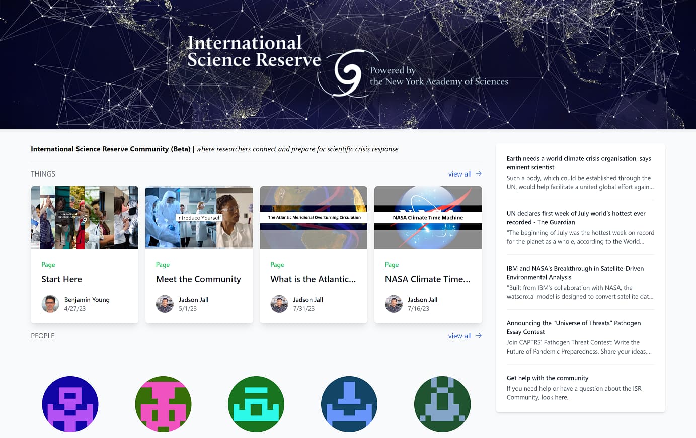
Earlier this year, the ISR launched a Beta version of a free, digital hub for the 4,000+ scientists in the ISR network. The ISR Community builds on the learnings from our first readiness exercise in 2022, a test case around wildfires, where we asked scientists to submit proposals for how they would manage a cross-border wildfire crisis and consider what tools and resources they would need.
In the wildfire test readiness exercise and throughout our ongoing conversations, ISR members were clear about the need for interdisciplinary, cross-geographic collaboration, and for easier and faster ways to engage in preparedness. We heard you. That’s why we built the ISR Community and have been working closely with Beta testers to ensure it is effective across disciplines and regions. A full, network-wide launch is expected in Fall 2023.
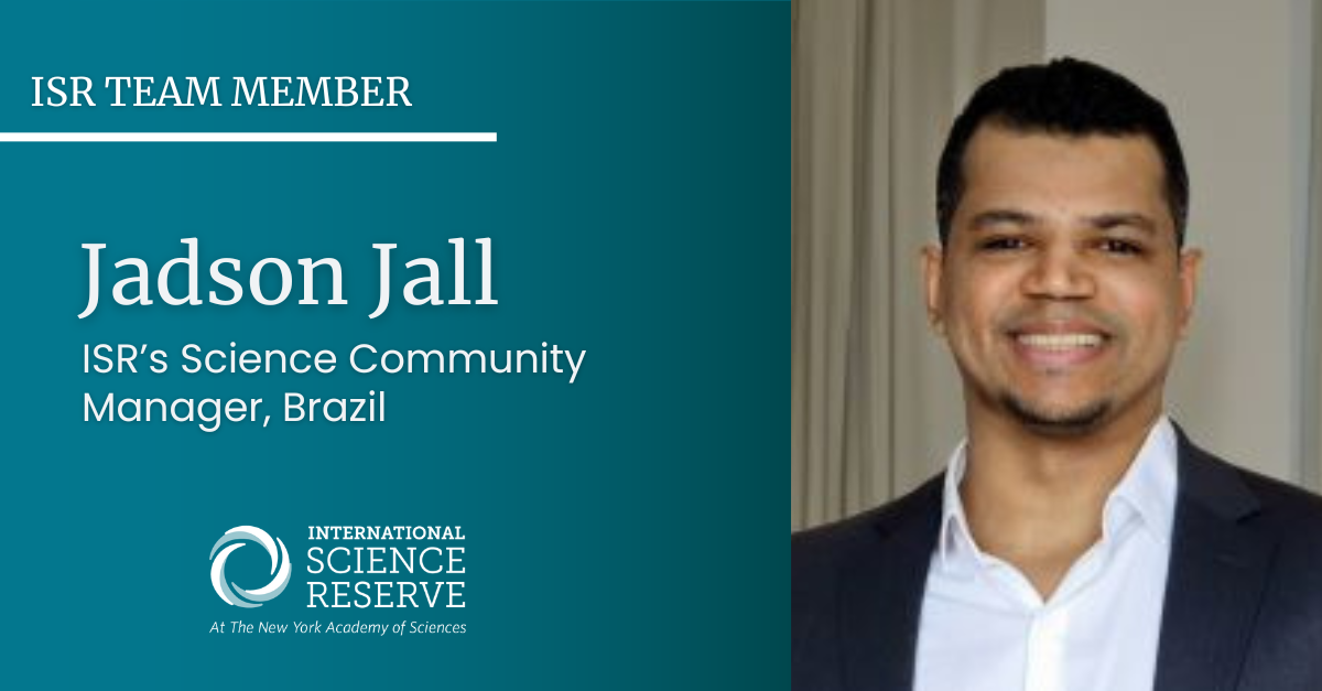
Recently, we sat down with Jadson Jall, the ISR’s first Science Community Manager to learn more about the digital hub’s progress. Jall is a geneticist from Brazil and has a passion for bringing scientists together to unlock the power of scientific collaboration as a key to solving humanity’s greatest challenges.
The global science community needs a network like the ISR because we live in a world with many compounding crises, such as pandemics and climate-related disasters. These crises are huge, affecting people and the environment in different countries and regions, and they are complex. That means they need lots of different kinds of responses and resources. So, one country’s scientific capabilities, or a single national science policy, can’t begin to resolve crises at that scale. An open, global network of scientists, such as the ISR, means individuals and institutions can pool resources and solve problems together, leading to faster and more effective responses to crises. Furthermore, the network’s principles, such as bringing together Scientists Without Borders and ensuring fair resource access, promoting collaboration, and including different voices, make it a much-needed platform for the current global scientific community.
In my dream world, a year from now, the International Science Reserve (ISR) hub would be a globally recognized and effectively functioning platform facilitating seamless personal connections and collaboration among scientists worldwide. It would have grown beyond its current network, and its resources would be even more diverse and plentiful. Scientists would use the hub to conduct and participate in readiness exercises and explore crisis scenarios, helping them prepare for various kinds and aspects of disasters and emergencies. The hub would also be a place where scientists would know where to go and how to apply to connect to different scientific and technical resources in different situations. Ideally, the hub would have a track record of successful crisis response efforts. That will demonstrate its effectiveness and reinforce its value, most importantly, by having a positive impact.
Active community pioneers – our earliest testers – engaged in discussions on diverse topics, from climate change crisis simulations to challenges in research collaboration. Our testers from varied locations and research backgrounds provided invaluable feedback, helping us to consistently refine our virtual environment to better foster scientific engagement and collaboration. For example, they helped us figure out which formats could work for the ISR’s Readiness Exercises and helped us try out various types of activities and collaborations. During the current Beta phase of the ISR Community, we continue to learn from our early adopters. It is clear that our community is eager to collaborate across borders, and I am doing my best as Community Manager to facilitate these connections and collaborations.
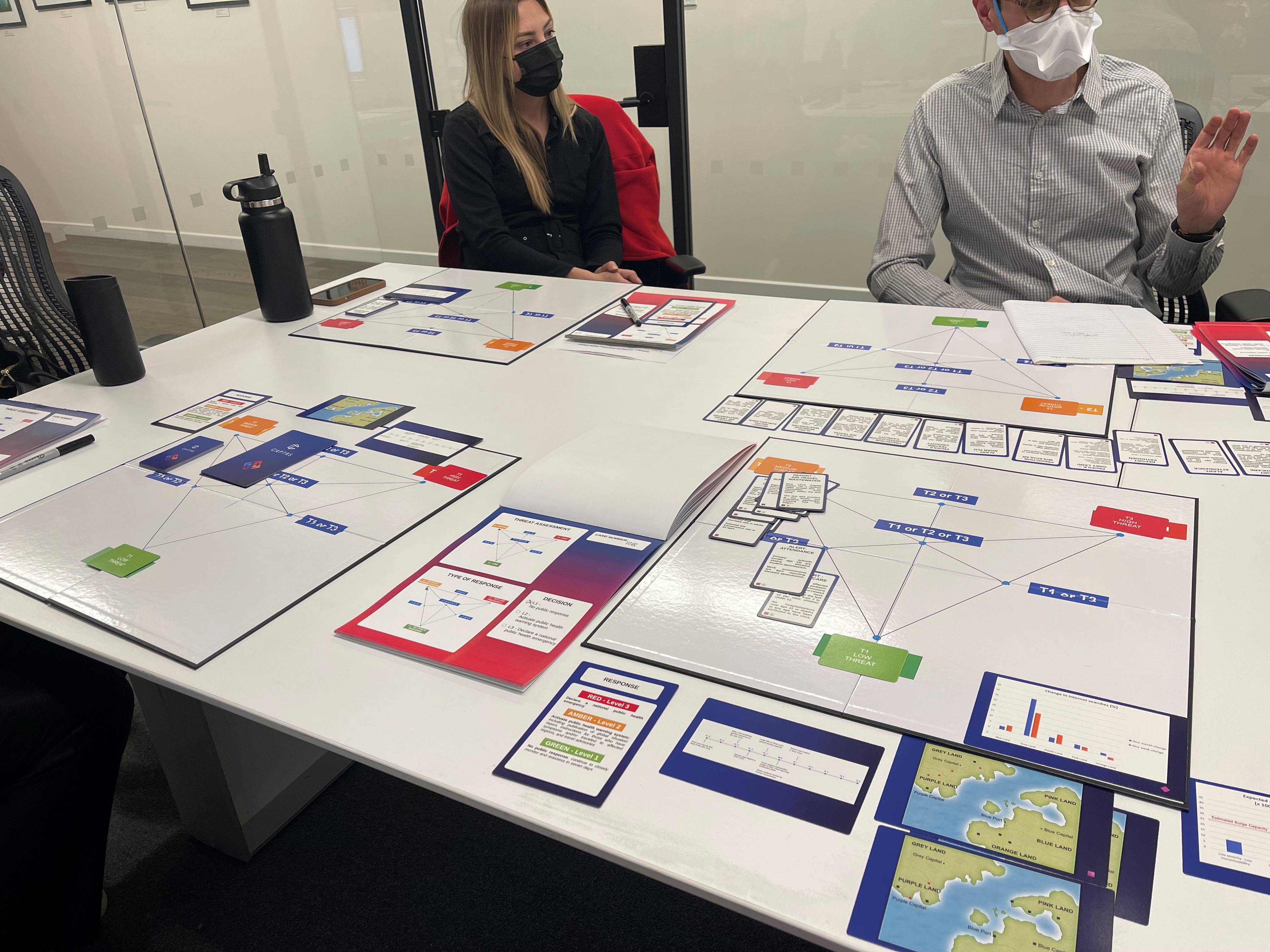
The ISR chose to use serious games as part of crisis readiness because it’s a fun way to learn about and improve the decision-making process, so that participants can feel they are undertaking the process themselves. Role-playing puts the participant in the position of learning about the crisis in real time and actively experiencing the dilemmas and decisions of how to respond, rather than learning about it afterward. These scenario-based simulation exercises allow researchers and decision-makers to practice analyzing available, often limited, information and making the best decisions, as quickly as possible.
Serious games will help members of the ISR Community explore decision making around issue areas such as water resource management, climate change adaptation, weather disasters, public health crises, and urban planning. These games serve as a hands-on and immersive way to understand the complexities and nuances of various crises and try different strategies for dealing with them.
The ISR’s serious games will be conducted online, in a collaborative, interactive format. These exercises will simulate various real-world crisis scenarios, and participants will devise and implement strategies to manage these crises. The activities are being designed to help participants better understand how resources will be deployed and managed in future crises and explore related decisions, helping to prepare us for scientific work in times of global crisis.
The ISR Community offers a rich suite of resources to its community of researchers and other stakeholders. They can be organized around two main areas. The first of these consists of specialized scientific resources such as high-performance computing, remote sensing, geospatial-temporal mapping, and databases. The ISR partners with organizations like IBM, UL Solutions, Google, Pfizer, and the National Science Foundation, offering various technical tools, data, and other resources. During a declared crisis, researchers will be able to log on to the ISR Community to gain access to resources like IBM’s Geospatial Discovery Network.
The other key resource of the ISR Community is our global network of over 4,000 scientists who have come together around a common goal. The ISR Community provides a space for this growing network to prepare, learn, collaborate, and be ready for crises. We will be offering different types of preparedness activities to help facilitate some of the community’s collaborations, and we are also planning special features for the fall based on the interests of the community.
I recommend that my fellow scientists join me in the ISR Community for a multitude of reasons, including:
So, the ISR Community is not only an opportunity to contribute to global crisis resolution but also a chance to grow professionally and expand our scientific horizons.
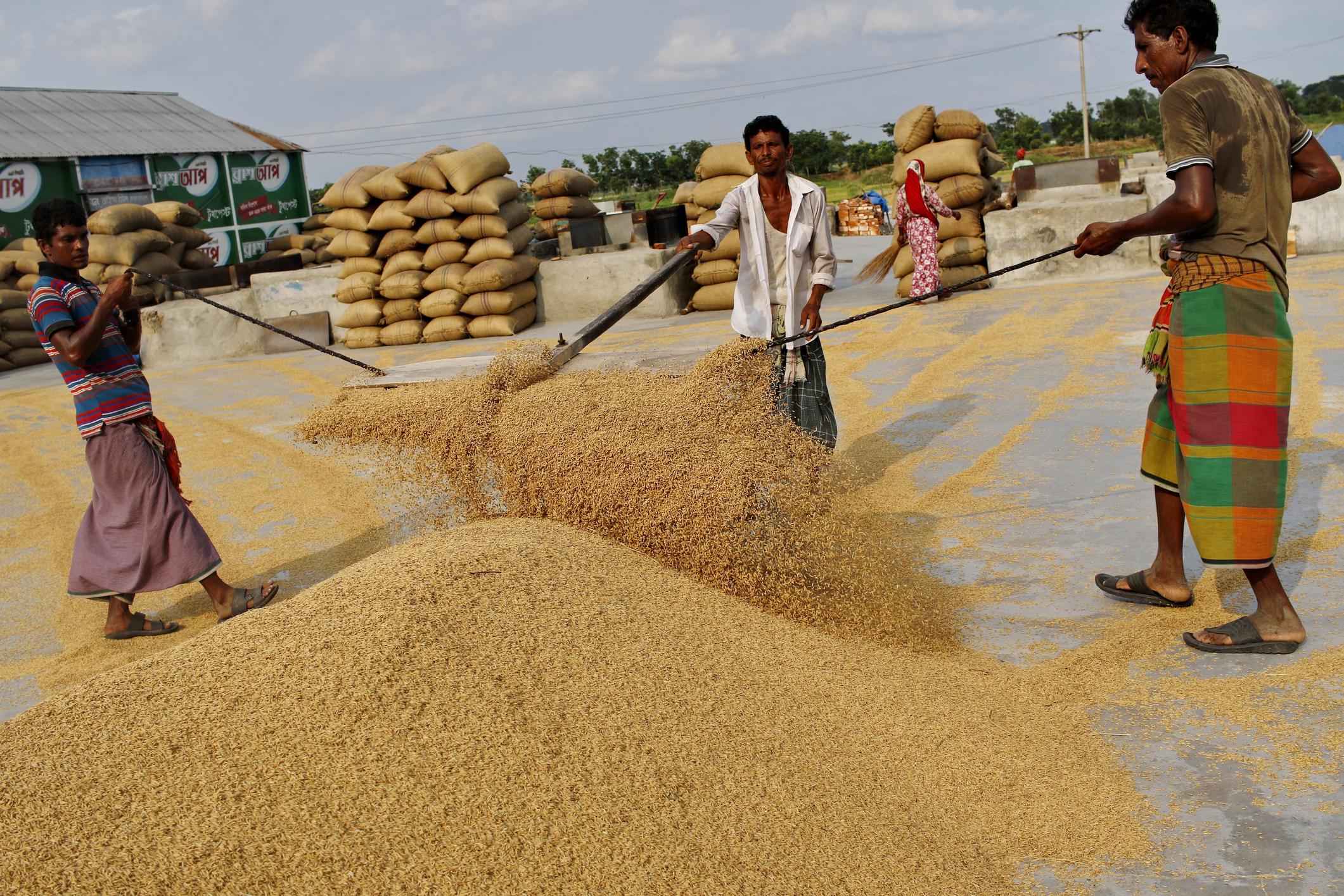
The world has enough food to feed everyone, yet the World Food Programme estimates that 345 million people around the world remain acutely food insecure in 2023.
Potentially further escalating this inequity, climate shocks are increasing the risks to agricultural yields. Heavy rainfall, droughts, and heatwaves can cause crop failures; climate and environmental pressures can decimate insect populations and microorganisms vital to plants and soil or let new crop pests or diseases emerge. Combined with a globalized distribution system and geopolitics, food system disasters are a compound problem.
To plan for or reduce the impact of these catastrophes, a variety of datasets, modeling, and analytical tools will be key, including observational data, remote sensing, geospatial mapping, and satellite imagery.
The International Science Reserve convened an expert panel from nonprofit and corporate perspectives across disciplinary and geographic boundaries to talk about the role of data in preparing for and responding to potential food system crises, as part of the International Science Reserve’s webinar series, Science Unusual: R&D for Global Crisis Response. Participants were:
Here are the top takeaways from the discussion:
Participants agreed about the urgent priority to get accurate data about what’s happening with food systems, weather, and climate patterns:
The information needs to include a wide range of data inputs to make sure it includes the “ground-truthing” from sources where people are seeing the most immediate impacts.
And in turn that the information, modeling and predictions should be made available to the communities who are most affected.
The panelists talked about climate impacts on specific food crop examples and ways that data-based planning can help deal with those impacts with alternative food sources or adapting agricultural cultivation methods.
Visit our events page to watch the full webinar.
International Science Reserve Honored as a Fast Company World Changing Idea
The International Science Reserve Recognized with Anthem Award for Crisis Response Partnerships
As part of our ongoing mission, the International Science Reserve (ISR) works to facilitate access during a crisis to specialized scientific and technical resources from public and private institutions. Over the last year, the ISR has interviewed dozens of members of our network – from Trinidad to Argentina – to hear directly from them about what they need to more effectively do their jobs.
Access to real-time, complex, and global data sets and modeling was often top of their lists. For example, if a Turkish wildfire researcher in hydrology is collaborating with a soil agronomist across the border in Greece in responding to regional wildfire disasters, the team needs stronger data resources. More complex data will help them to understand wildfire spread related to water and land use patterns and it can contribute to advance plans to limit future damage across borders.
This is where the ISR can help fill in the gaps. Scientists face multiple barriers to conducting applied research in times of crisis – especially in contexts and countries where funding is inconsistent and advanced data resources are limited. IBM and the International Science Reserve are partnering to increase access to specialized, curated data and analytics during global crises. This first-of-its-kind partnership will help the international scientific community in responding quickly and effectively to crises, such as climate-related disasters.
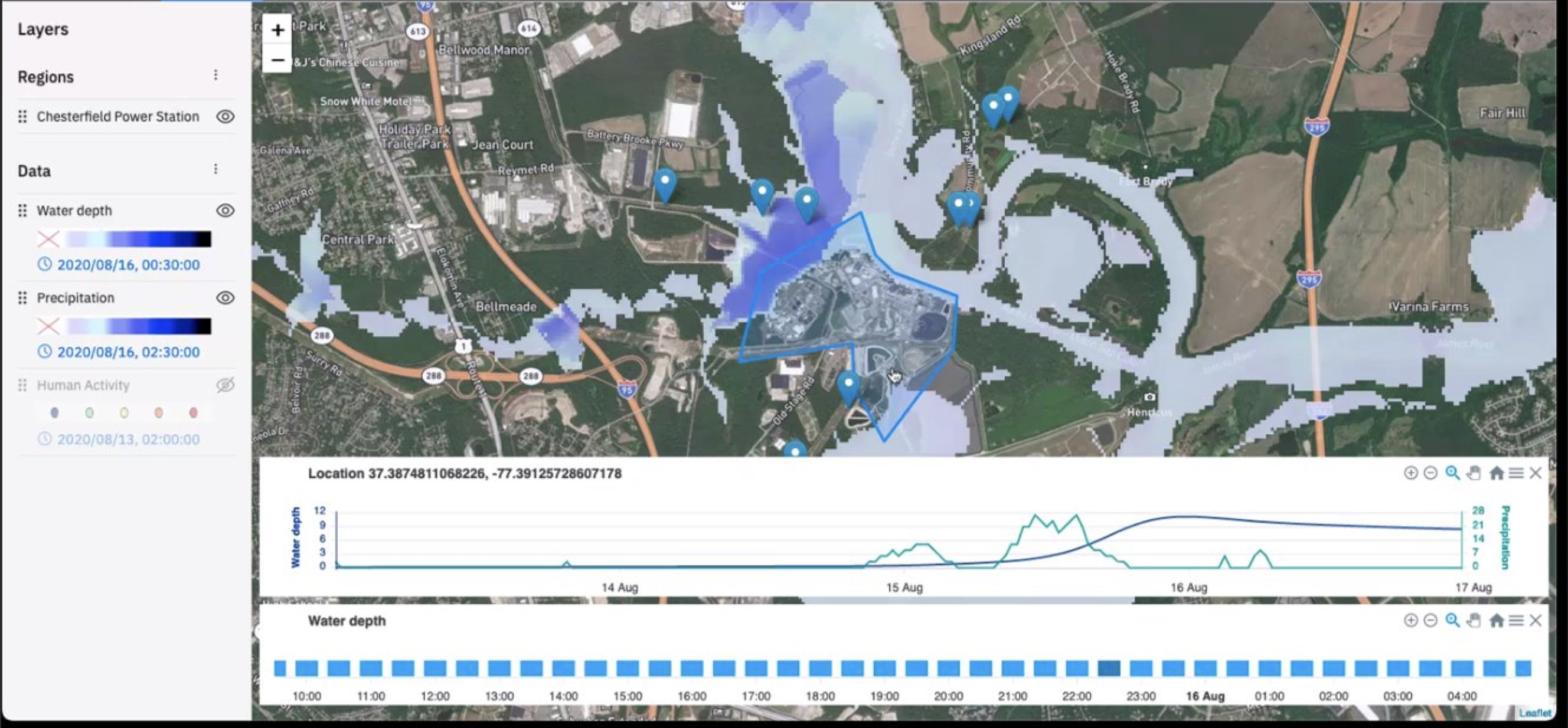
IBM will offer its Geospatial Discovery Network (GDN) – a set of data and information discovery and modeling technologies designed to anticipate environmental disruption and manage risk – to support the ISR’s scientific network in addressing the worst impacts of disasters, such as damage to people, communities, and livelihoods from heatwaves, wildfires and flooding. GDN’s data resources originate from IBM’s Environmental Intelligence Suite, and include hundreds of geodata sets from sources like satellite imagery, to which IBM applies analytics and AI for modeling.
We know that access to this type of data works. For nearly a decade, IBM has been helping businesses improve sustainability and manage the negative impacts of the changing climate, including:
IBM and the ISR plan to offer access to the IBM Geospatial Discovery Network to ISR’s network of researchers, at no cost, through a customized, fast-tracked process. When the ISR declares a crisis, scientists in the network will be able to apply to use the tools for projects that involve transnational research collaboration. In the coming months, we will offer scientists in our network the chance to explore crisis scenarios and simulations in which they could use IBM’s GDN tools and to practice submitting proposals through the new application process
We at the ISR are grateful to IBM for stepping up to reduce the red tape and break down borders to increase access to high-quality data and modeling tools for more researchers.